

Newsroom
-
 New Scientific Results of Topographic Analysis and Mineral Retrieval from Chang’e-4 Data
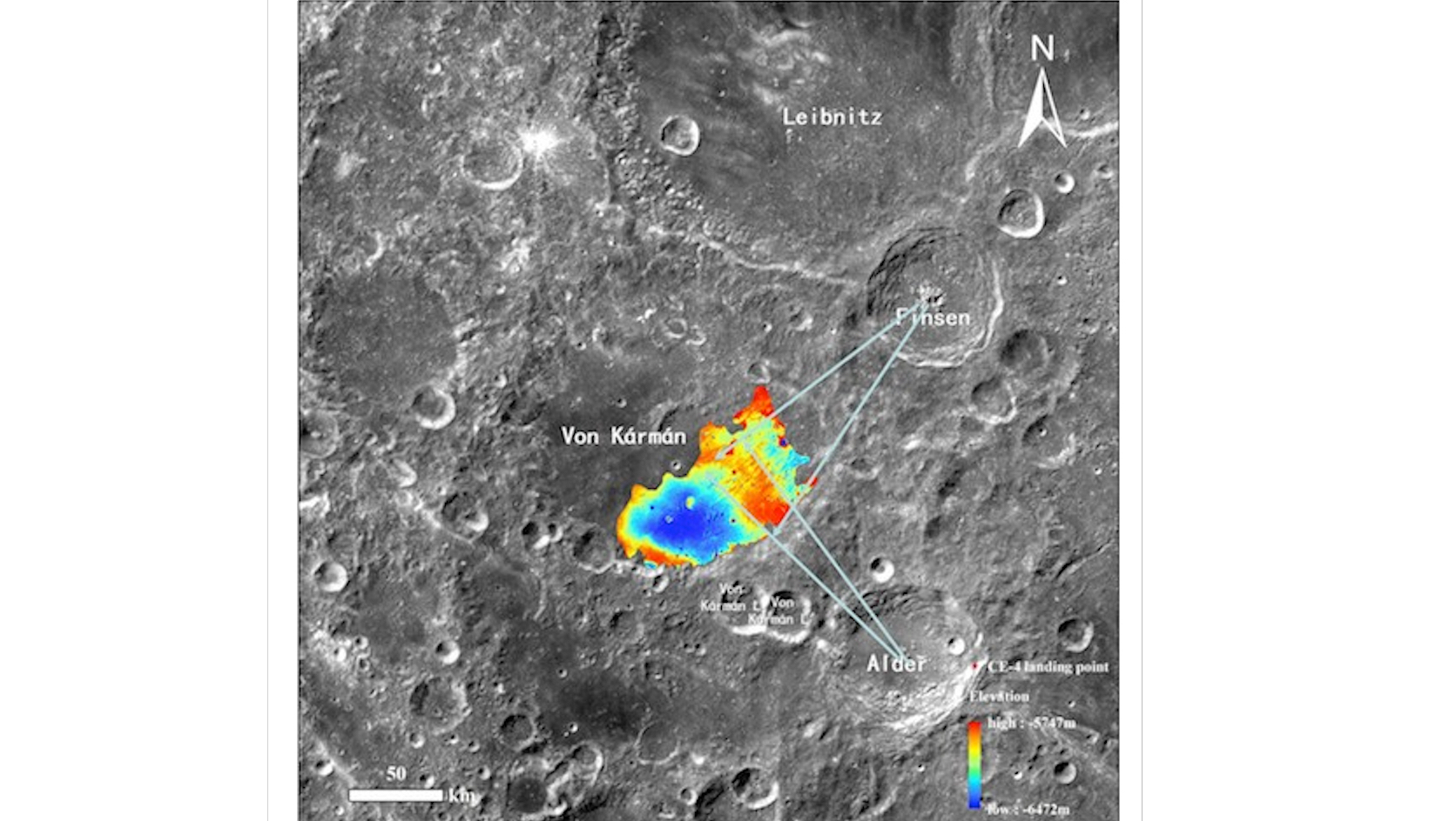
The Planetary Remote Sensing team of State Key Laboratory of Remote Sensing Science performs scientific studies on topographic evolution analysis and surface mineral retrieval using images and spectral data acquired by the Yutu-2 rover. A series of recent research results are briefly summarized below.
01 Jun 2020 -
 China Ecosystem Spectral Observation Network in Place
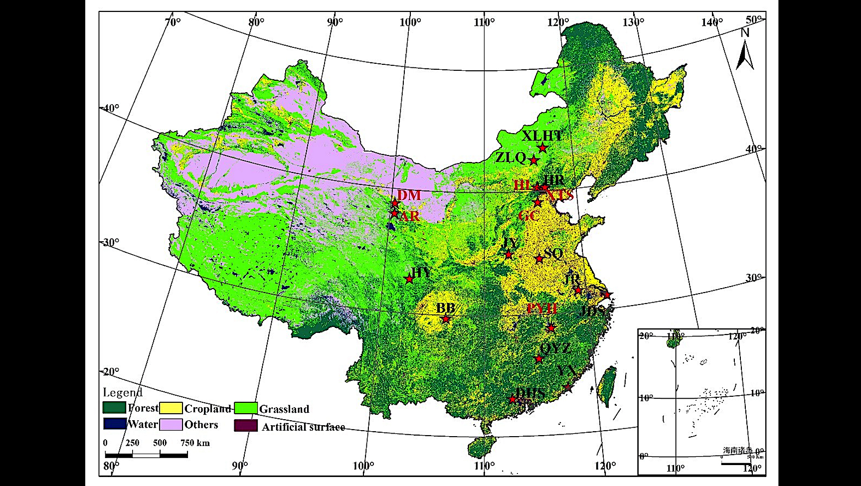
From late April to early May, a research team led by Prof. LIU Liangyun at the Aerospace Information Research Institute (AIR) under the Chinese Academy of Sciences (CAS) organized a compaign of construction and annual maintenance of six sites under the China Ecosystem Spectral Observation Network (ChinaSpec for short).
20 May 2020 -
 Big Earth Data Indexed by Scopus
Big Earth Data (hereinafter referred as BEDJ), the world's first big data journal on Earth sciences, has been accepted for inclusion in Scopus, the largest abstract and citation database of peer-reviewed literature, marking a milestone that ensures articles published in the journal easily found, and enables authors of the journal to keep track of how often their articles cited by others.
14 May 2020 -
 Scientists Develop New Physically-Based Soil Moisture Index from Passive Microwave Observations
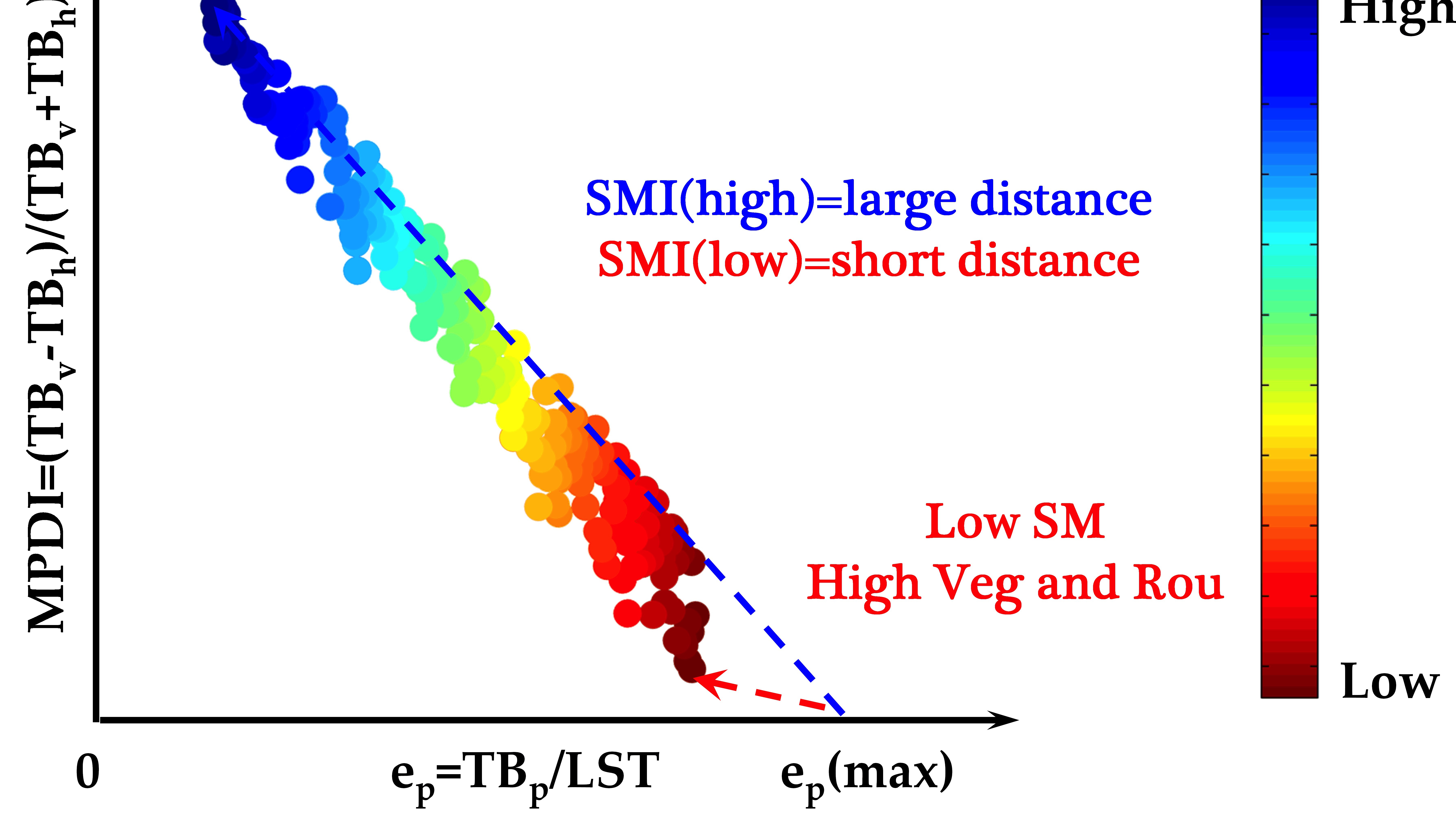
Soil moisture (SM) is a pivotal hydrological variable that links the terrestrial water, energy, and carbon cycles. Dr. ZENG Jiangyuan from the Aerospace Information Research Institute (AIR), together with his collaborators have developed a new soil moister index (SMI) to capture the temporal variability of SM. The research has been published in IEEE Transactions on Geoscience and Remote Sensing with the title of "a physically based soil moisture index from passive microwave brightness temperatures for soil moisture variation monitoring".
28 Apr 2020 -
 Paper on Big Earth Data Science Selected into Earth Day 2020 Collection
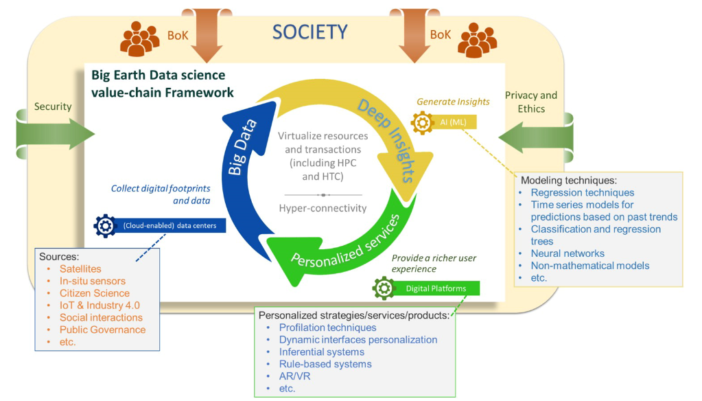
Taylor & Francis Group has recently selected a collection of 15 papers featuring environmental protection from its publications during 2017 to 2020 as a promotion of Earth Day 2020 (April 22). The collection papers are available at https://think.taylorandfrancis.com/earth-day-2020-article-collection/ for free until May 30, 2020. A paper entitled "Big Earth Data science: an information framework for a sustainable planet" , which is co-authored by Prof. GUO Huadong from AIR together with JRC collaborators and published in the International Journal of Digital Earth has been selected into the article collection.
24 Apr 2020 -
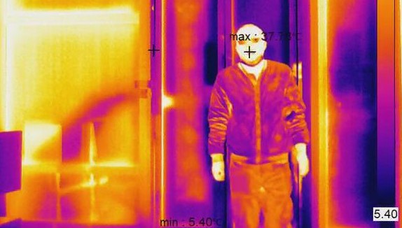 Infrared Thermal Imaging Temperature Screening System to Help Fight Virus Pandemic
AIR has recently developed an infrared thermal imaging temperature screening system, capable of automatically measuring body temperature with high accuracy and efficiency.
03 Apr 2020

