

Newsroom
-
 CAS Releases Assessment Report on Jiuzhaigou World Heritage Site Recovering from Earthquake
A remote sensing assessment report released by the Aerospace Information Research Institute (AIR) under the Chinese Academy of Sciences (CAS) shows that Jiuzhaigou in southwest China's Sichuan Province is recovering from an earthquake on August 8, 2017.
12 Aug 2020 -
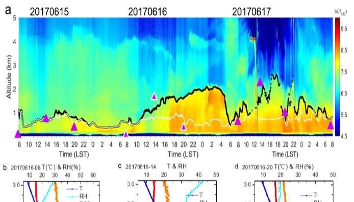 Study Reveals Long-term Characteristics of Atmospheric Mixing Layer Height over Beijing
A research team led by Prof. LI Zhengqiang from the National Engineering Laboratory of Remote Sensing Satellite Application under the Aerospace Information Research Institute, Chinese Academy of Sciences, has made progress in pinpointing the characteristics of the atmospheric mixing layer height (MLH) over Beijing by laser radar (lidar). The paper titled "Determination and climatology of diurnal cycle of atmospheric mixing layer height over Beijing 2013-2018: Lidar measurements and implication for air pollution” was published online on July 27 in the journal of Atmospheric Chemistry and Physics.
07 Aug 2020 -
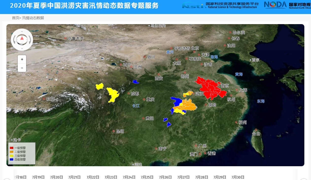 China Launches Website on Summer Flood Data
BEIJING, Aug. 4 (Xinhua) -- A dedicated website containing data on summer flood disasters in China has been launched, the Aerospace Information Research Institute of the Chinese Academy of Sciences announced Tuesday.
05 Aug 2020 -
 AIR Launches Program on SAR Microwave Vision 3D Imaging
AIR has recently launched a NSFC funded research program on realizing SAR three-dimensional (3D) imaging from microwave vision, a new method that integrates microwave scattering mechanism and image visual semantics to realize 3D reconstruction, meanwhile reduces the number of observations required for 3D imaging.
31 Jul 2020 -
 AIR Scientists Map Lunar Craters in Candidate Chang’e-5 Landing Area
A research team from the State Key Laboratory of Remote Sensing Science with the Aerospace Information Research Institute (CAS) has made a precise lunar crater map within the planned landing area of CE-5, as well as a surface age analysis of the craters. The research was published on the Earth and Planetary Science Letters titled “a catalogue of impact craters larger than 200 m and surface age analysis in the Chang'e-5 landing area”.
28 Jul 2020 -
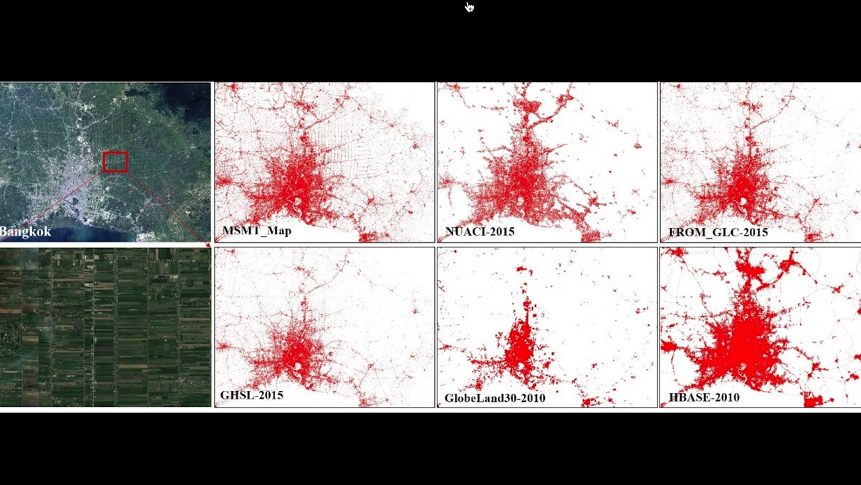 CAS Releases Global 30-m Impervious Surface Map
According to the Aerospace Information Research Institute (AIR), Chinese Academy of Sciences (CAS), a research team led by Prof. LIU Liangyun has released global 30-m impervious surface datasets with an accuracy of 95.1 %, the highest accuracy among existing data products of this kind. The related paper has been published in the journal Earth System Science Data, with the title of “Development of a global 30-m impervious surface map using multi-source and multi-temporal remote sensing datasets with the Google Earth Engine platform”.
24 Jul 2020

