

Newsroom
-
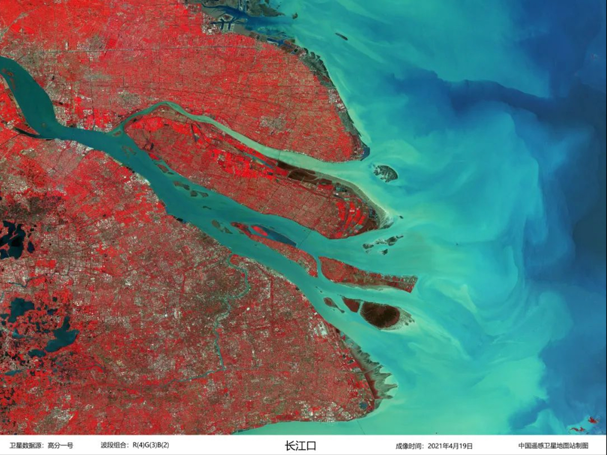 Sceneries from Space
A collection of images captured by satellites show several Chinese landscapes from space. The images are processed by the engineers from the China Remote Sensing Satellite Ground Station, a big science research facility hosted by the Aerospace Information Research Institute (AIR), Chinese Academy of Sciences (CAS).
23 Oct 2022 -
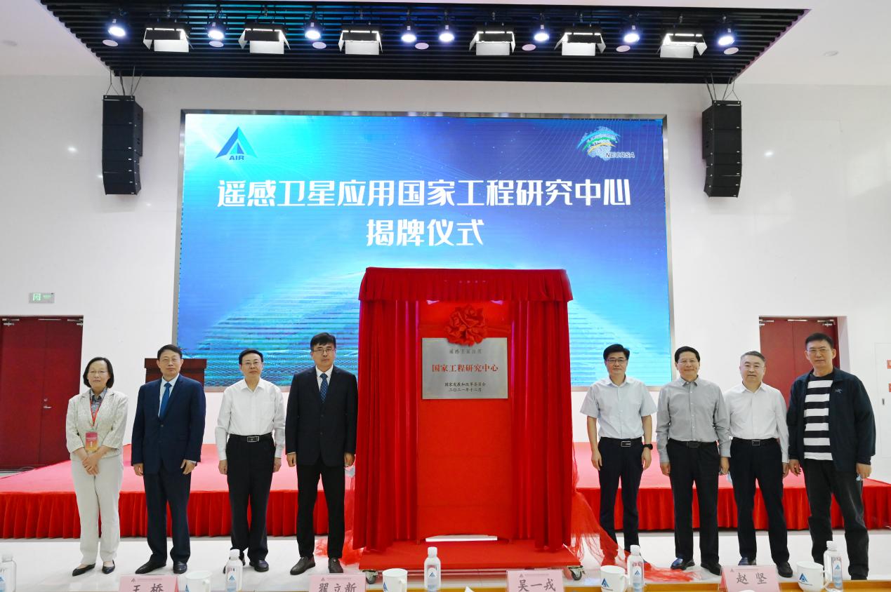 National Engineering Research Center for Remote Sensing Satellite Applications Unveils in Beijing
The National Engineering Research Center for Remote Sensing Satellite Applications was unveiled in Beijing on September 27, 2022, according to the Aerospace Information Research Institute (AIR), Chinese Academy of Sciences (CAS).
09 Oct 2022 -
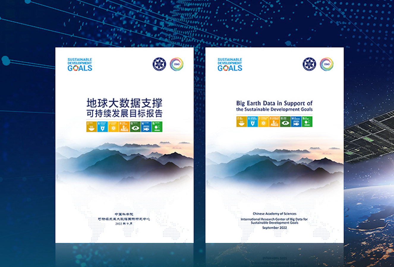 2022 Report on Big Earth Data in Support of the Sustainable Development Goals Released
The Report on Big Earth Data in Support of the Sustainable Development Goals (2022) was released by the Chinese side at the Ministerial Meeting of the Group of Friends of the Global Development Initiative (GDI) held in New York on September 20 local time, according to the Aerospace Information Research Institute (AIR), Chinese Academy of Sciences (CAS).
26 Sep 2022 -
 China Unveils Research Data from SDGSAT-1 Satellite
China has started to provide free access to data globally from the Sustainable Development Science Satellite 1 (SDGSAT-1) for scientific research, according to the International Research Center of Big Data for Sustainable Development Goals (CBAS), its developer, on Tuesday.
25 Sep 2022 -
CAS Big Earth Data Research Results Released to Support Global Sustainable Development
On September 20, 2022 local time, State Councilor and Foreign Minister Wang Yi chaired the Ministerial Meeting of the Group of Friends of the Global Development Initiative (GDI) held in New York.
23 Sep 2022 -
Chinese FM Proposes Seven Steps to Implement Global Development Initiative
NEW YORK, Sept. 20 (Xinhua) -- Chinese State Councilor and Foreign Minister Wang Yi chaired here Tuesday the Ministerial Meeting of the Group of Friends of the Global Development Initiative (GDI).
21 Sep 2022

