AI-Powered Radar Technique Reconstructs Cities in 3D with Greater Detail and Accuracy
A team of Chinese researchers has developed a powerful new method to create highly detailed 3D models of cities using radar data, helping overcome long-standing challenges in urban mapping. By combining artificial intelligence (AI) with building geometry, the new technique—called Geo-SETRA—can produce clearer, more complete images of urban landscapes, potentially transforming how cities are monitored, planned, and protected.
The study, published in the Journal of Remote Sensing, was conducted by scientists from the Aerospace Information Research Institute (AIR) of the Chinese Academy of Sciences. They developed Geo-SETRA to improves a technology known as Tomographic Synthetic Aperture Radar (TomoSAR), which uses radar signals to reconstruct 3D environments. Traditional methods often struggle in cities, where complex structures like high-rise buildings and narrow alleys interfere with radar signals, leading to blurry or incomplete images.
Geo-SETRA solves this by using the shapes and patterns of buildings themselves—such as rooftops, walls, and windows—as guidance. These visual clues are built into the algorithm’s decision-making process, helping it “fill in the blanks” and sharpen details.
"Our approach represents a new synergy between geometric modeling and radar imaging," said Dr. WANG Chunyi, lead author of the study. "By allowing visual semantics to guide radar-based reconstruction, we significantly enhance detail and completeness without compromising efficiency."
Unlike conventional SAR processing methods, Geo-SETRA doesn't rely on heavy post-editing. Instead, it uses a smart, multi-stage pipeline that begins with a rough 3D map and refines it using computer vision techniques to identify key architectural features. These features are then used as statistical "priors" in a Bayesian model to guide the reconstruction process.
Tested on both simulated and drone-based radar data over Suzhou city in eastern China, the algorithm achieved sub-meter elevation accuracy and preserved small structural elements that other techniques often miss—such as window frames and rooftop edges. It also performed better than existing methods in low signal environments and produced denser point clouds, retaining more than 80% of key data points.
"Our findings show that it's possible to improve radar imaging by understanding the language of city architecture," said Wang." This could reshape how we use airborne or spaceborne systems for smart city development, infrastructure monitoring, and disaster response."
The research team believes Geo-SETRA could be integrated into next-generation urban monitoring platforms. Its efficiency and precision also make it ideal for large-scale 3D city modeling, especially when combined with data from satellites, drones, LiDAR, or optical sensors.
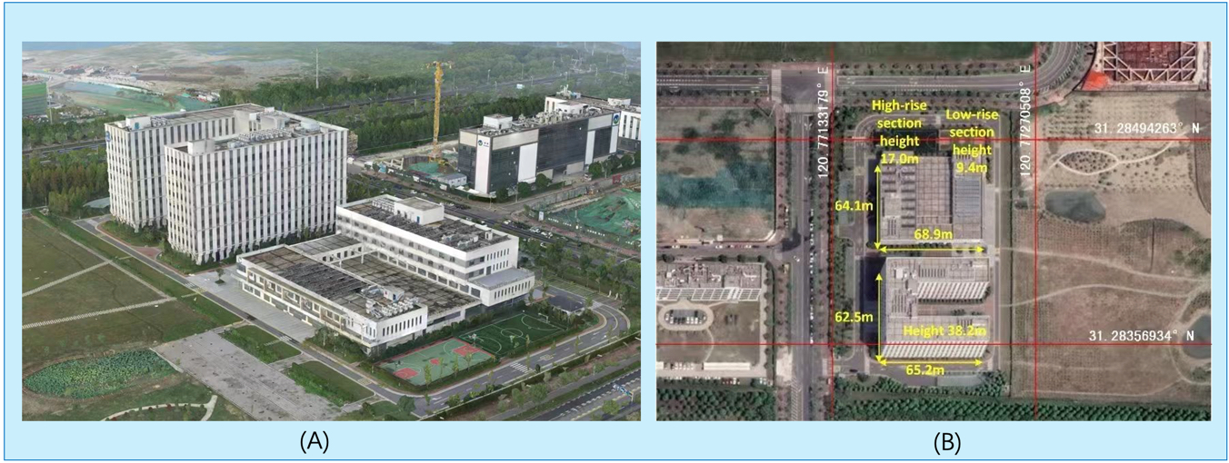
Optical images of the surveyed area (A) oblique photography (B) top view with information annotated. (Image by AIR)
News & Events