Satellite Model Tackles Hotspot Effect, Boosting Land Surface Temperature Accuracy by 20%
Land surface temperature (LST) component—including soil and vegetation temperatures—play a vital role in understanding Earth's energy balance, water cycles, and agricultural systems. However, accurately measuring these components from space has been challenging due to limited observations information and large retrieval noises, particularly hotspot effect in which temperature readings vary significantly depending on the sun-sensor viewing geometry.
A new study by researchers at the Aerospace Information Research Institute (AIR) of the Chinese Academy of Sciences, published in Remote Sensing of Environment introduces a three-component temperature retrieval model that synergizes multi-angle thermal infrared observations from polar-orbiting and geostationary satellites with considering hotspot effect and temperature difference.
Key findings reveal that satellite retrieved temperatures change up to 0.6 K for every 10-degree variation in the viewing angle relative to the Sun. By accounting for such hotspot effect, the proposed method improves temperature retrieval accuracy by more than 20% compared to traditional approaches.
"Separating sunlit and shaded components is key to capturing real-world thermal heterogeneity," explained LU Yifan, the study's first author and a PhD candidate at AIR. "Our model provides the foundation for operational temperature component products that can enhance climate and agricultural assessments."
This research was supported by Chinese Natural Science Foundation Project (42271362, 42130111, 42471365). The research team has made the first global component (soil / leaf) temperature dataset publicly available through the National Tibetan Plateau Data Center, supporting further scientific and environmental applications.
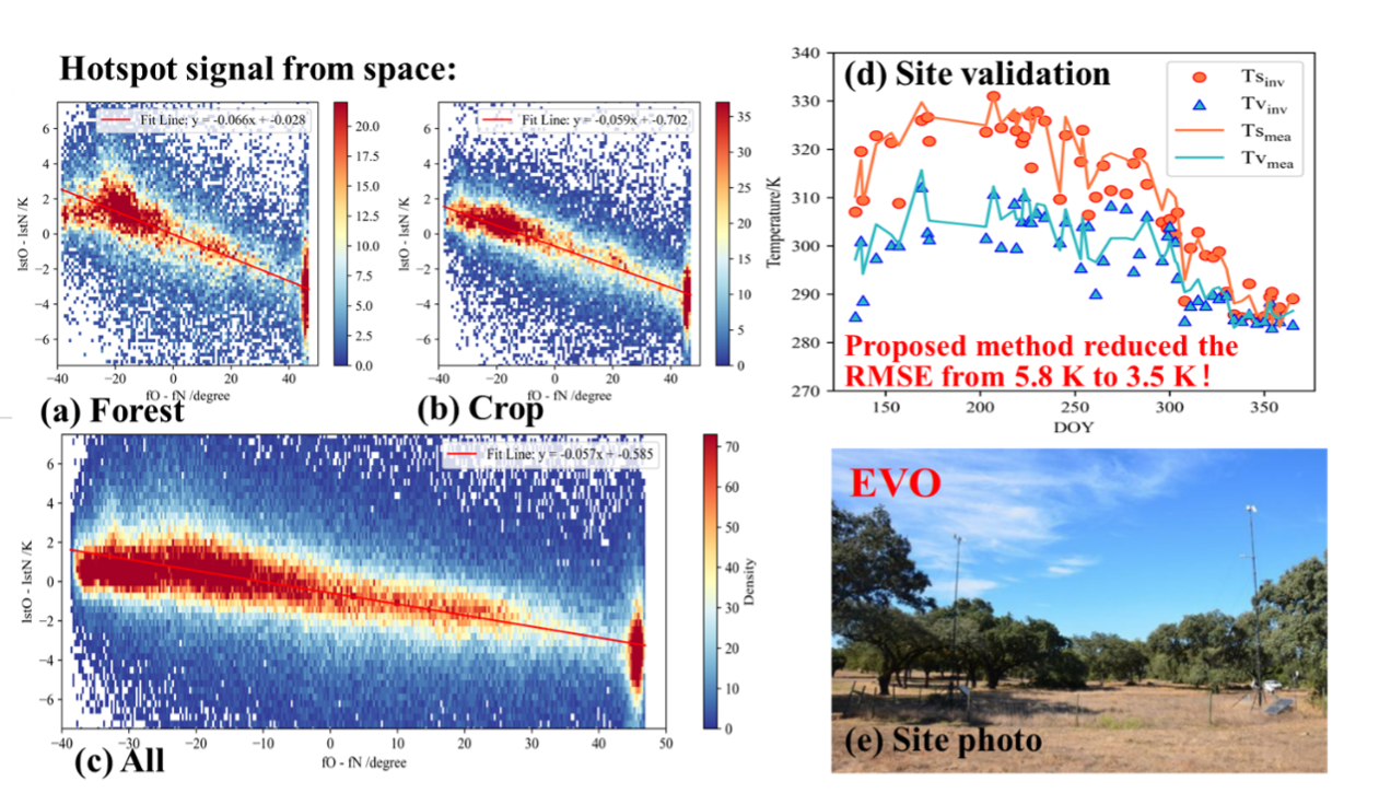
(a-c) presents the observed hotspot signatures from space for different surface types: forest, cropland, and all types. (d–e) present the validation results and a site photograph. Compared to traditional retrieval methods, the proposed approach reduces the RMSE from 5.8 K to 3.5 K. (Image by AIR)
News & Events