China GEO Supports Thai Chemical Factory Explosion Disaster Response
An explosion in a chemical factory close to the Thai capital, Bangkok, on July 5 has caused casualties and extensive damage to surround areas.
Responding to requests from the United Nations Economic and Social Commission for Asia and the Pacific (UNESCAP) and the Geo-Informatics and Space Technology Development Agency (GISTDA), ChinaGEO Secretariat activated its Disaster Data Response (CDDR) Mechanism to provide high-resolution satellite imagery in support of disaster response.
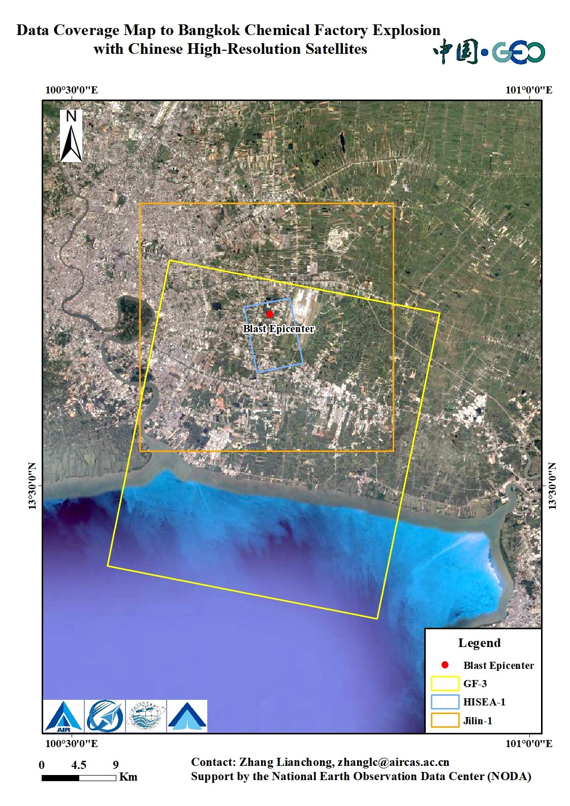
More than five China's satellites arranged the emergency observation plan for the explosion spot and its surrounding area within 15 miles. Within 48 hours, 12 GB satellite before and after-disaster data, including 0.98m resolution optical image (Jilin-1 satellite) and 1m resolution radar image (HISEA-1 satellite), were provided to Thai authorities.
ChinaGEOSS Data Sharing Network and National Earth Observation Data Center (NODA) also shared these data to the United Nations Institute for Training and Research (UNITAR) for the rapid damage mapping. The map illustrates 328 potentially damaged structures of which 13 are destroyed and 315 are severely or moderately damaged.
Established in 2016, the CDDR Mechanism is responsible for coordinating the provision of Chinese high-resolution satellite data and disaster analysis products to disaster-affected countries. The mechanism has been successfully activated for earthquakes, floods, tsunamis, and typhoons of 28 countries.
News & Events