Improved Offset Tracking for Pre-disaster Deformation Monitoring
The synthetic aperture radar (SAR) remote sensing is a powerful technology for long-term monitoring of landslide-prone areas due to its advantages of all-day and all-weather observations. The Spaceborne Microwave Remote Sensing System Department from the Aerospace Information Research Institute (AIR) has made some progress on using SAR remote sensing technology for pre-disaster deformation monitoring. A research paper titled "Improved Offset Tracking for Pre-disaster Deformation Monitoring of the 2018 Jinsha River Landslide (Tibet, China)", has been published in Remote Sensing of Environment (RSE, IF=8.791), one of the top SCI academic journals in the remote sensing field.
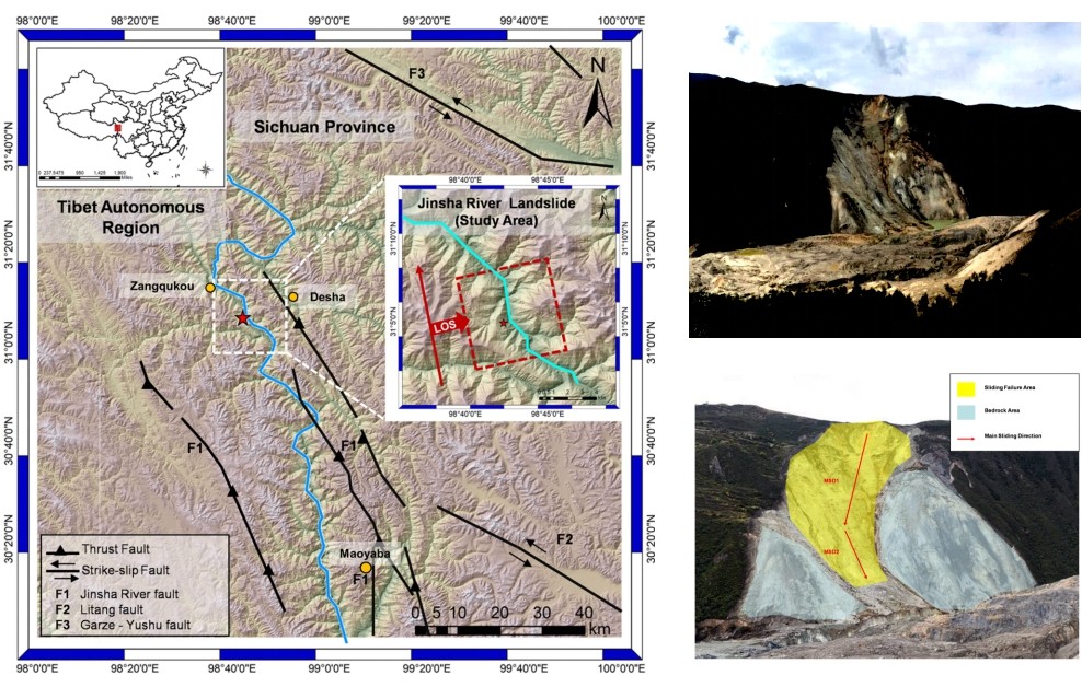
Fig. 1. Geological setting of the 2018 Jinsha River landslide.
The traditional offset tracking technology is based on the similarity monitoring of the signal intensity of the same target in two SAR images by calculating the offset between the two SAR images. As a monitoring method of surface deformation, it works well for fast-moving landslides (more than tens of cm/yr). However, the traditional method may present some limitations, such as (i) a high dependence of estimation window design on experience, (ii) a tradeoff between the accuracy of single points and the overall efficiency, and (iii) a low confidence in the results caused by heterogeneous in-window samples.
The researchers improve the offset tracking method for landslide monitoring. An improved algorithm called adaptive incoherence speckle offset tracking based on homogeneous samples (AISOT-HS) is proposed for non-saliency regions, and the workflow is optimized by a “preparation” step added before offset estimation to distinguish between feature matching and speckle pattern matching.
The method is also used to study the evolution of the 2018 Jinsha River landslide (Tibet, China) using SAR data from the Gaofen 3 (GF-3) satellite and the Advanced Land Observing Satellite-2 (ALOS-2) satellite.
Compared with the traditional method, the proposed method improves the efficiency and reduces the uncertainty. The researchers also analyze the spatiotemporal displacement pattern of this landslide, which shows that the Jinsha River landslide was most likely a thrust load-caused landslide.
This study demonstrates the role of SAR remote sensing in global landslide monitoring, especially in the places where ground truth data are scarce.
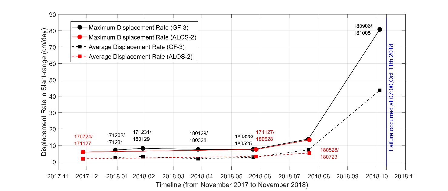
Fig.2 Temporal displacement patterns of the 2018 Jinsha River landslide.
This work is financially supported by the National Key R&D Program of China (grant no. 2017YFB0502700), the National Natural Science Funds (grant no. 61901444 and grant no. 61901443), and the National Science Fund for Distinguished Young Scholars (grant no. 61825106).
News & Events