-
HIST Holds Training Workshop
Oct 16, 2020
-
AIR Launches Journal of Remote Sensing
The Journal of Remote Sensing was launched in October to publish high-quality, online-only, and open-access publications to benefit the Earth observation community, according to the Aerospace Information Research Institute (AIR), Chinese Academy of Sciences (CAS).
Oct 16, 2020
-
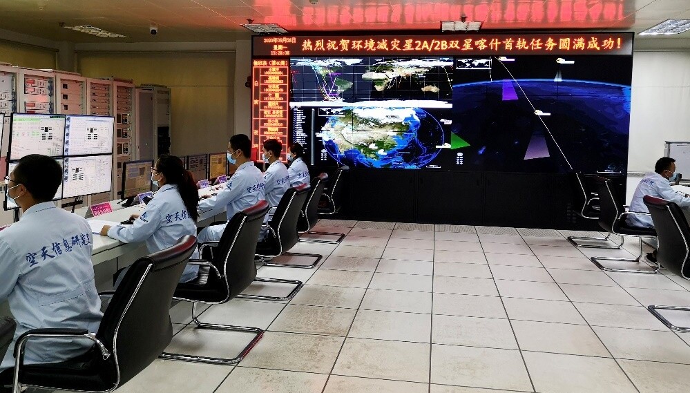
China Receives Data from Newly-Launched Environment Monitoring Satellites
BEIJING, Sept. 29 (Xinhua) -- China Remote Sensing Satellite Ground Station has received data from two newly-launched environment monitoring satellites, sources with the Chinese Academy of Sciences said Tuesday.
Sep 29, 2020
-
2020 Report on Big Earth Data in Support of the Sustainable Development Goals Released
The report on "Big Earth Data in Support of the Sustainable Development Goals (2020)" was released on September 26, 2020 by the Chinese government at an video-conference on Poverty Eradication and South-South Cooperation, on the occasion of the 75th anniversary of the founding of the United Nations.
Sep 27, 2020

-
CAS to Launch Int’l Research Center of Big Data for SDGs
China will set up an International Research Center of Big Data for Sustainable Development Goals (SDGs) to facilitate the implementation of the UN 2030 Agenda, announced Chinese President XI Jinping during his UN General Assembly address on September 22, 2020.
Sep 26, 2020
-
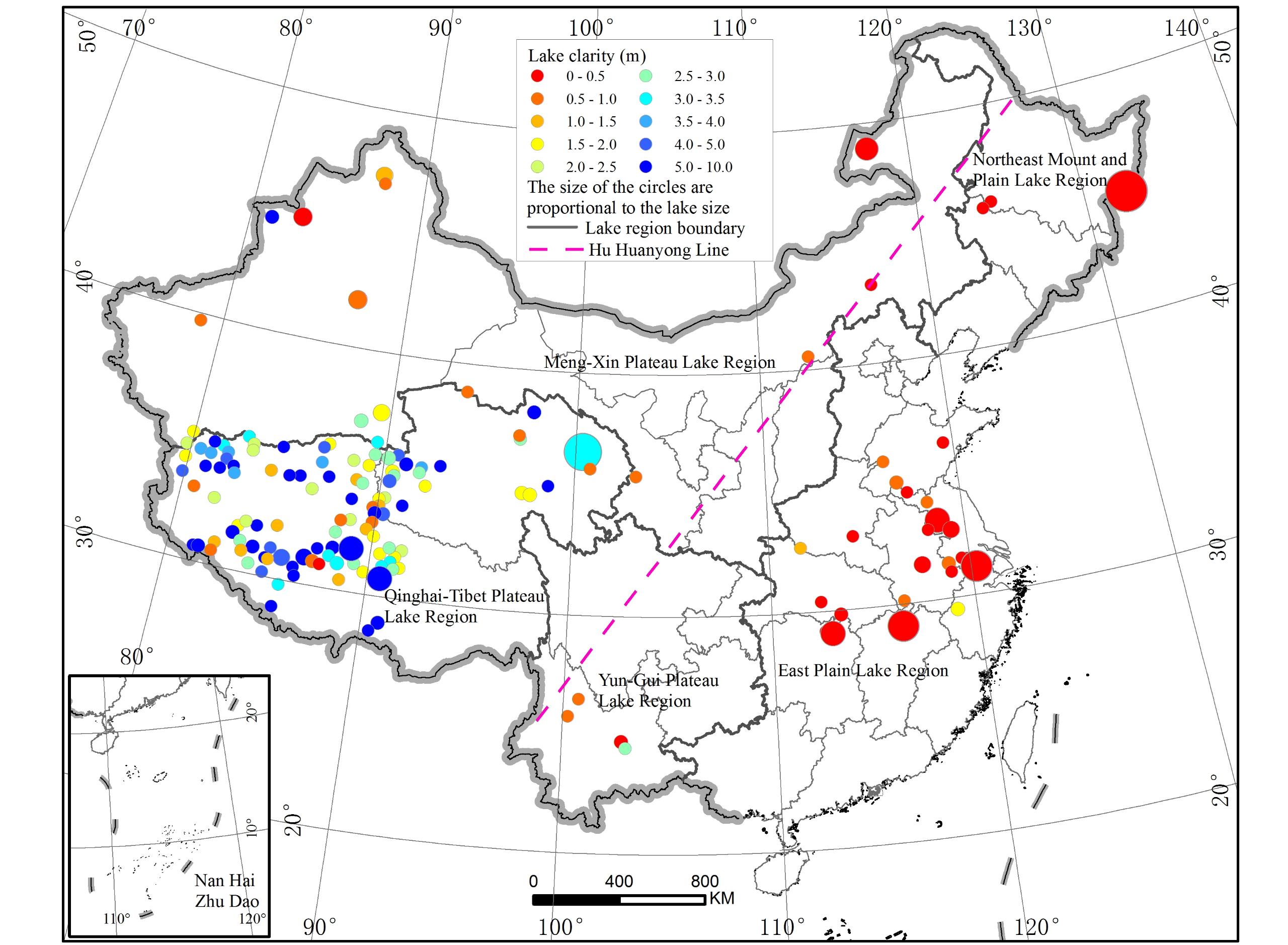
Remote Sensing Study Reveals Increasing Water Clarity of China's Lakes
The water clarity of lakes across China shows a significant spatial pattern of “higher in the West while lower in the East”, and an overall ever-increasing water clarity over the past two decades, according to a research based on remote sensing algorithm on MODIS measurements for 153 large lakes and reservoirs nationwide from 2000 to 2017.
Sep 15, 2020
-
Chinese Institute Introduces Remote Sensing to Forecast Pest Attacks
BEIJING, Aug. 31 (Xinhua) -- China has launched a remote sensing system for plant pests and disease monitoring and forecasting, according to the Aerospace Information Research Institute of the Chinese Academy of Sciences.
Aug 31, 2020
-
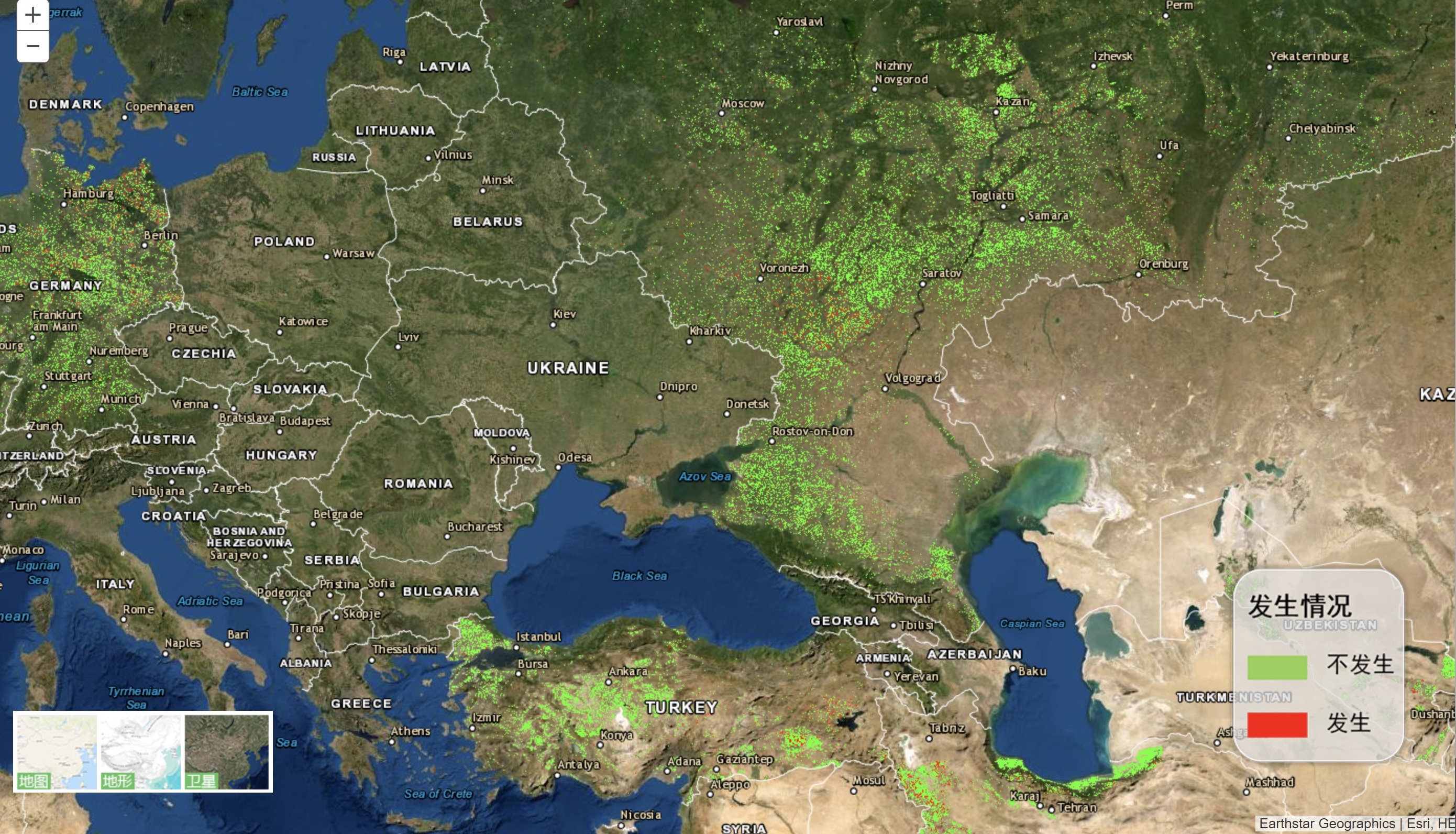
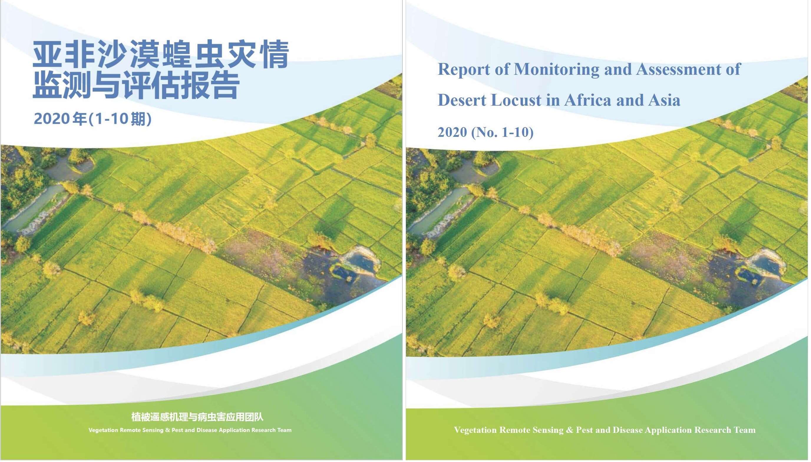
Chinese Researchers Release Reports on Desert Locusts in Asia and Africa
Researchers from the Aerospace Information Research Institute of the CAS drafted a report on the core breeding areas and migration path of desert locusts in Asia and Africa between 2018 and 2020, as well as assessment of losses to agriculture and animal husbandry caused by desert locusts in hard-hit countries including Pakistan, Ethiopia and Kenya.
Aug 17, 2020

-
Space Information Services Safeguard Chinese Ships in Arctic
BEIJING, Aug. 12 (Xinhua) -- Chinese researchers used remote sensing and model forecast data to help Chinese merchant ships Tian'en and Tianyou safely navigate the Northeast Passage of Arctic this summer.
Aug 13, 2020

-
Quake-hit Jiuzhaigou's Water Environment Restoring: Remote Sensing Study
BEIJING, Aug. 10 (Xinhua) -- A remote sensing study shows that the water environment of the Jiuzhaigou scenic spot in southwest China's Sichuan Province has started to rehabilitate after being hit by an earthquake, according to the Chinese Academy of Sciences (CAS).
Aug 11, 2020
-
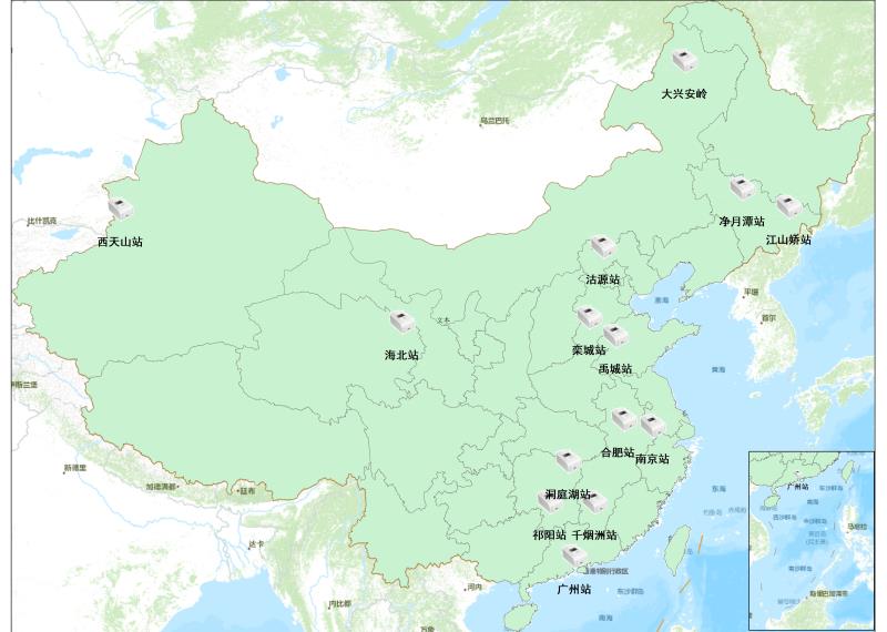
China Builds Automatic Leaf Area Index Monitoring Network
BEIJING, July 29 (Xinhua) -- Chinese researchers have realized continuous national-scale ground observation of the leaf area index by building an automatic monitoring network, according to the Aerospace Information Research Institute of the Chinese Academy of Sciences on Wednesday.
Jul 29, 2020
-
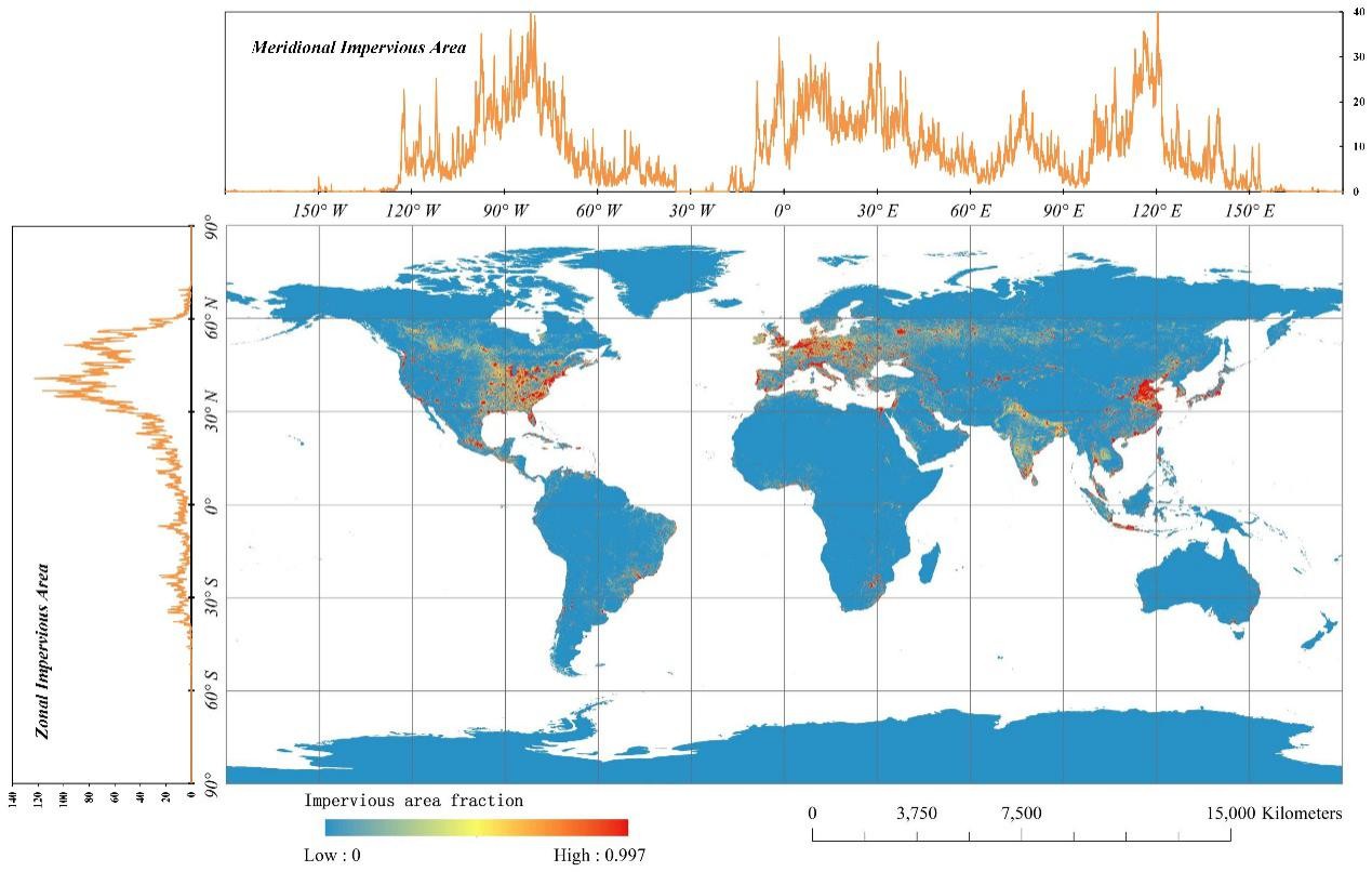
Chinese Researchers Undertake Impervious Surface Mapping
BEIJING, July 28 (Xinhua) -- Chinese researchers have generated a global 30-meter impervious surface map with high accuracy.Researchers from the Aerospace Information Research Institute under the Chinese Academy of Sciences derived the global impervious and non-impervious training samples and generated an accurate global impervious surface map at a resolution of 30 meters for 2015 based on multi-source multi-temporal remote sensing datasets.
Jul 29, 2020
-
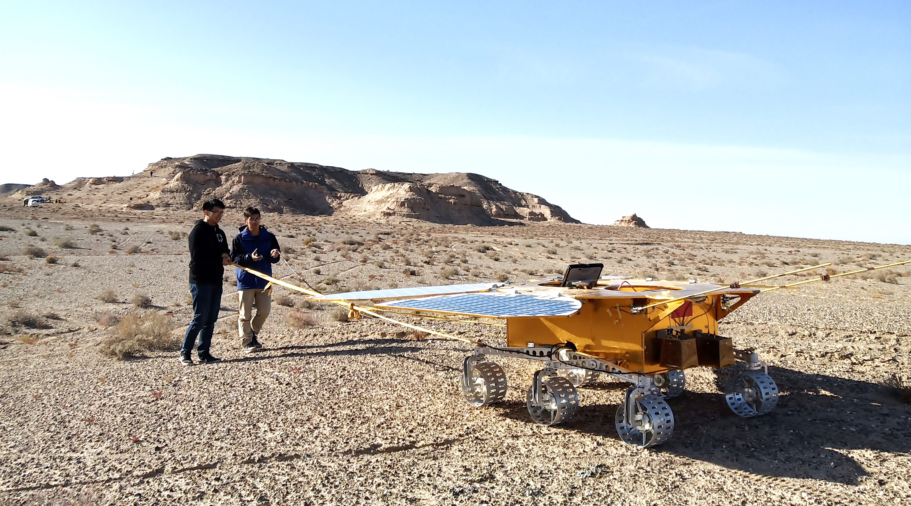
China's Probe Radar to Explore Internal Structure of Mars
BEIJING, July 24 (Xinhua) -- After landing on Mars, China's Tianwen-1 probe will detect the surface and internal structure of the red planet by using its onboard radar equipment.A ground-penetrating radar, a key probe instrument, was developed by the Aerospace Information Research Institute under the Chinese Academy of Sciences. It is expected to survey the Martian soil and ice, and to collect data about the structure beneath the planet's surface at depths of between 10 and 100 meters.
Jul 25, 2020
-
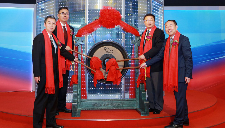
Geovis Technology Co., Ltd Listed on SSE STAR MARKET
On July 8, 2020, the Geovis Technology Co., Ltd (GEOVIS), a high tech company controlled by the Aerospace Information Research Institute (AIR), made its debut on the sci-tech innovation board at the Shanghai Stock Exchange, also known as SSE STAR Market, with opening gains of 425%.
Jul 20, 2020
-
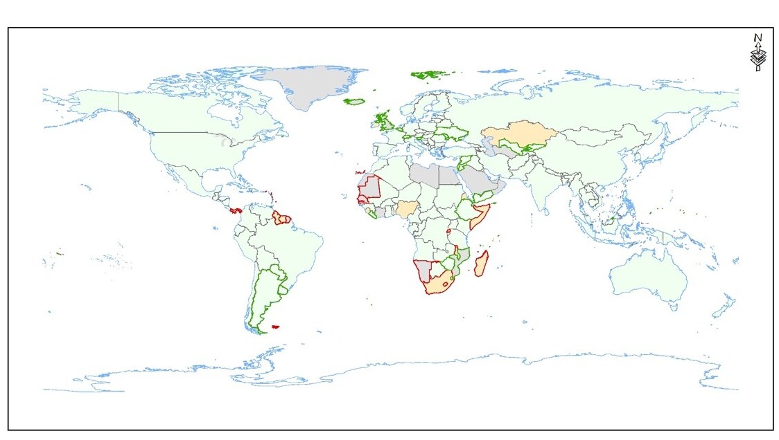
China Realizes Land Degradation Neutrality
On June 17, the 26th World’s Desertification and Drought Day, The CAS “ Big Earth Data Science Engineering” Program (CASEarth) released their research results of using big Earth data in support of land degradation neutrality assessment along Belt and Road Region.The report shows that China has achieved land degradation neutrality in advance, and the net land restoration area accounts for 18.24% of the world's total, ranking first in the world, and contributing greatly to global land degradation neutrality.
Jun 19, 2020
News & Events