Latest Satellite Images of China from LANDSAT-9
The China Remote Sensing Satellite Ground Station (RSGS), a major national S&T facility hosted by the Aerospace Information Research Institute (AIR) under the Chinese Academy of Sciences (CAS), has recently acquired the capability to receive, process and distribute the data product transmitted from the LANDSAT-9 satellite.
The LANDSAT-9 satellite was launched last September and started operation this year.
The satellite images include several spots across China which are recently captured by LANDSAT-9. The images are processed by the engineers from RSGS.
LANDSAT-9 image captured on Feb. 25,2022, a composite of bands 6-5-4, shows Baotou, the largest city in north China’s Inner Mongolia. (Image Credit: RSGS)
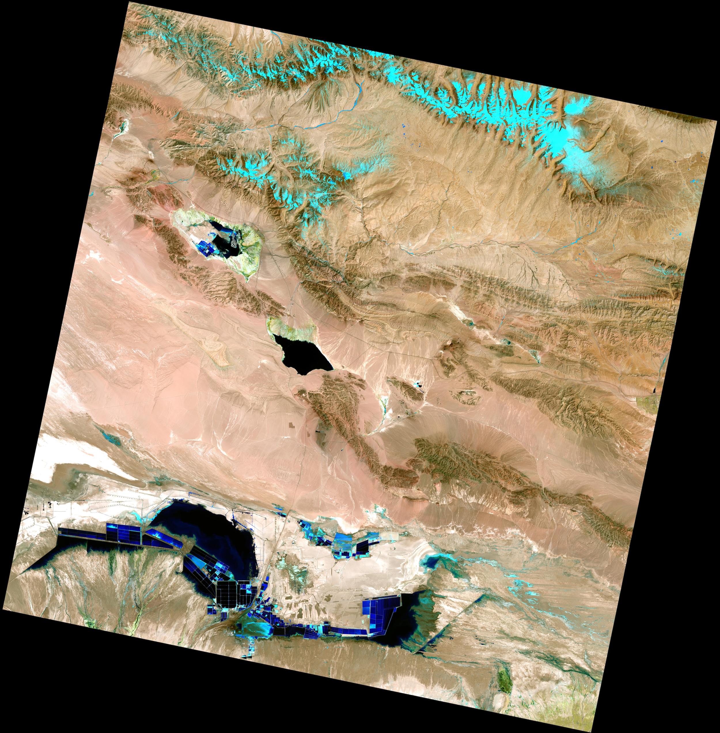
LANDSAT-9 image acquired on April 6, 2022, shows the Salt Lakes, Da Qaidam/Xiao Qaidam lakes, and Qarhan Salt Lake in northwest China's Qinghai Province. Qarhan Salt Lake is the largest of its kind in China. (Bands 6-5-4) (Image Credit: RSGS)
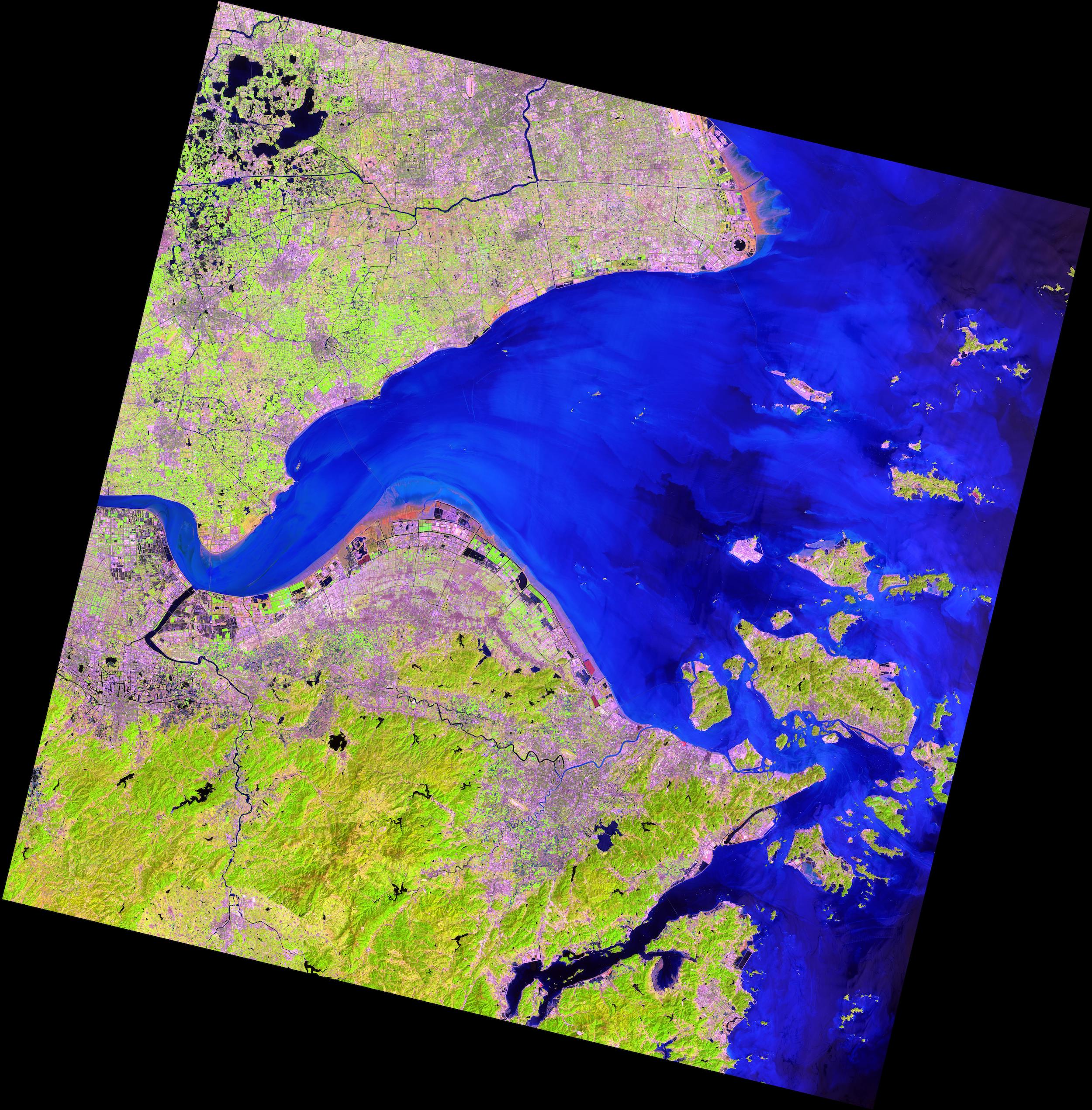
LANDSAT-9 image captured on April 8, 2022, shows Hangzhou Bay, a funnel-shaped inlet of the East China Sea, bordered by the province of Zhejiang and the municipality of Shanghai. (Bands 6-5-4) (Image Credit: RSGS)
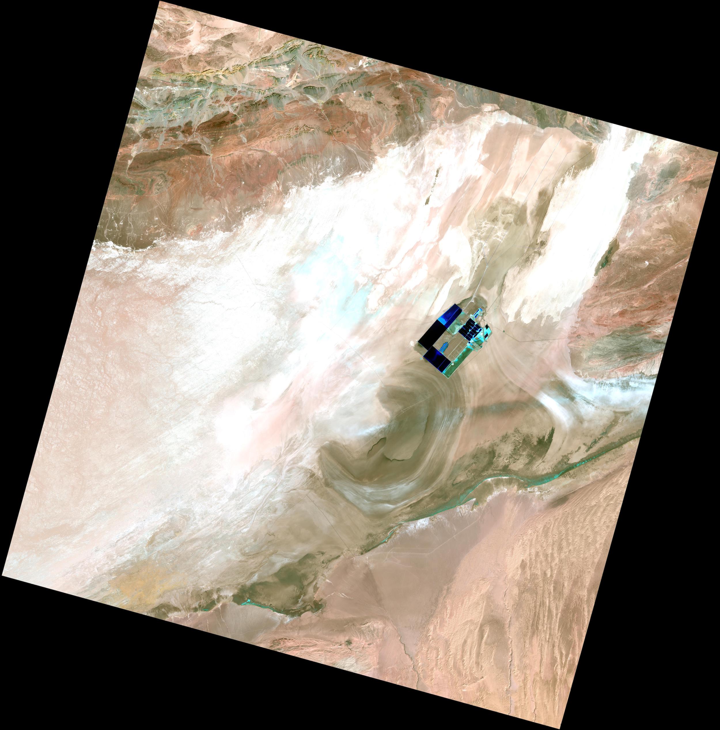
LANDSAT-9 image captured on April 2, 2022, a composite of bands 6-5-4, presents the "Big Ear" of Lop Nur in northwest China’s Xinjiang. (Image credit: RSGS)
LANDSAT-9 image captured on April 6,2022, a composite of bands 6-5-4, shows Nanjing, the capital of Jiangsu Province of the East China. (Image credit: RSGS)
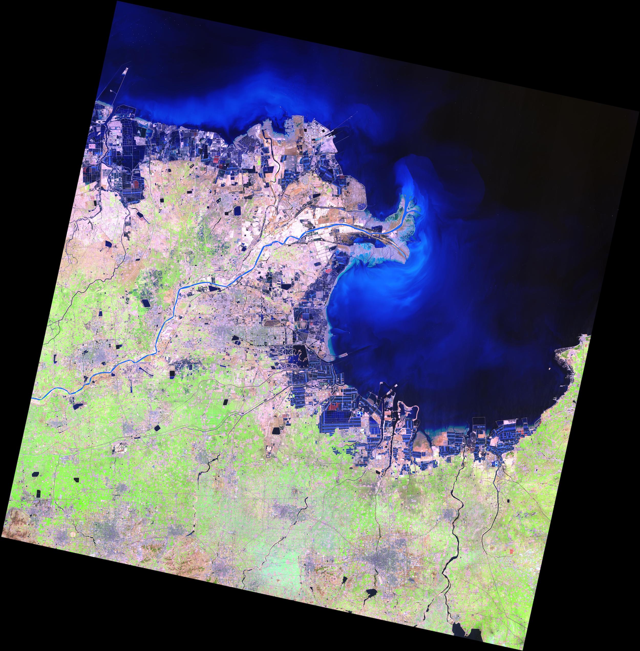
LANDSAT-9 image captured on March 28,2022, a composite of bands 6-5-4, shows Dongying, a prefecture-level city, lies on the northern (Bohai Sea) coast of Shandong province in north China. (Image credit: RSGS)
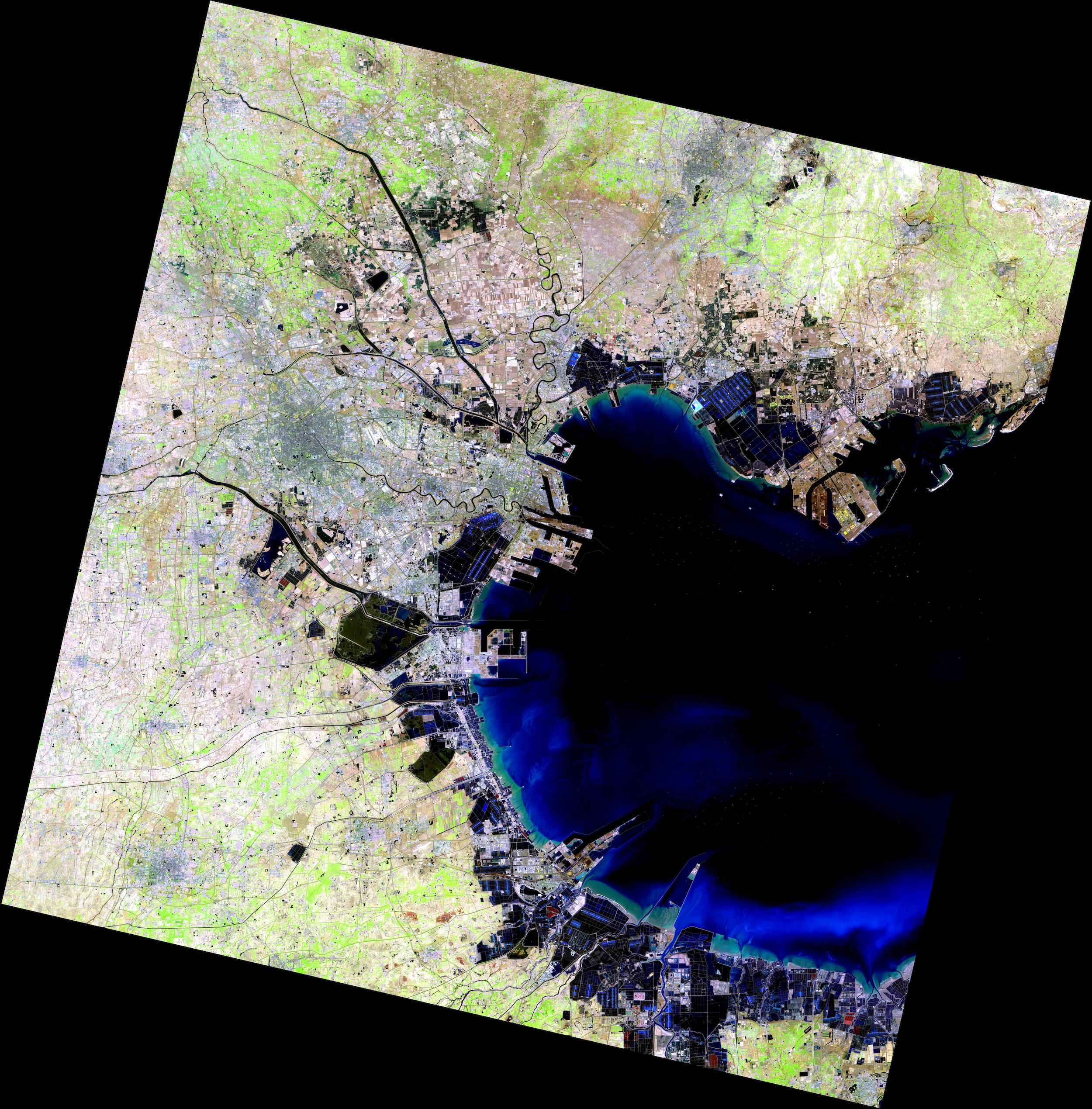
LANDSAT-9 image, captured on April 4,2022, a composite of bands 6-5-4, shows the Port of Tianjin, the largest port in northern China. The port is on the western shore of the Bohai Bay. (Image credit: RSGS)
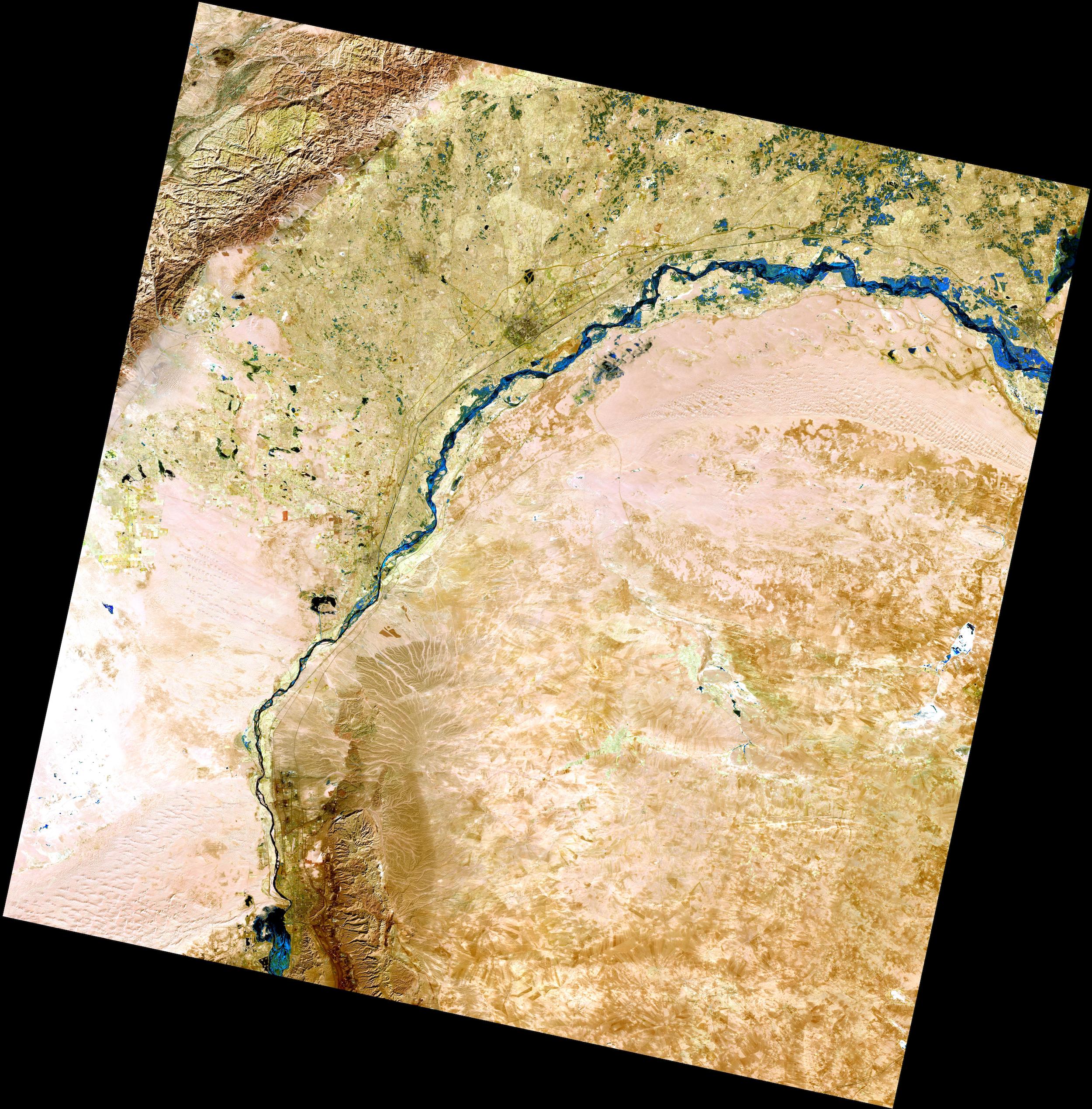
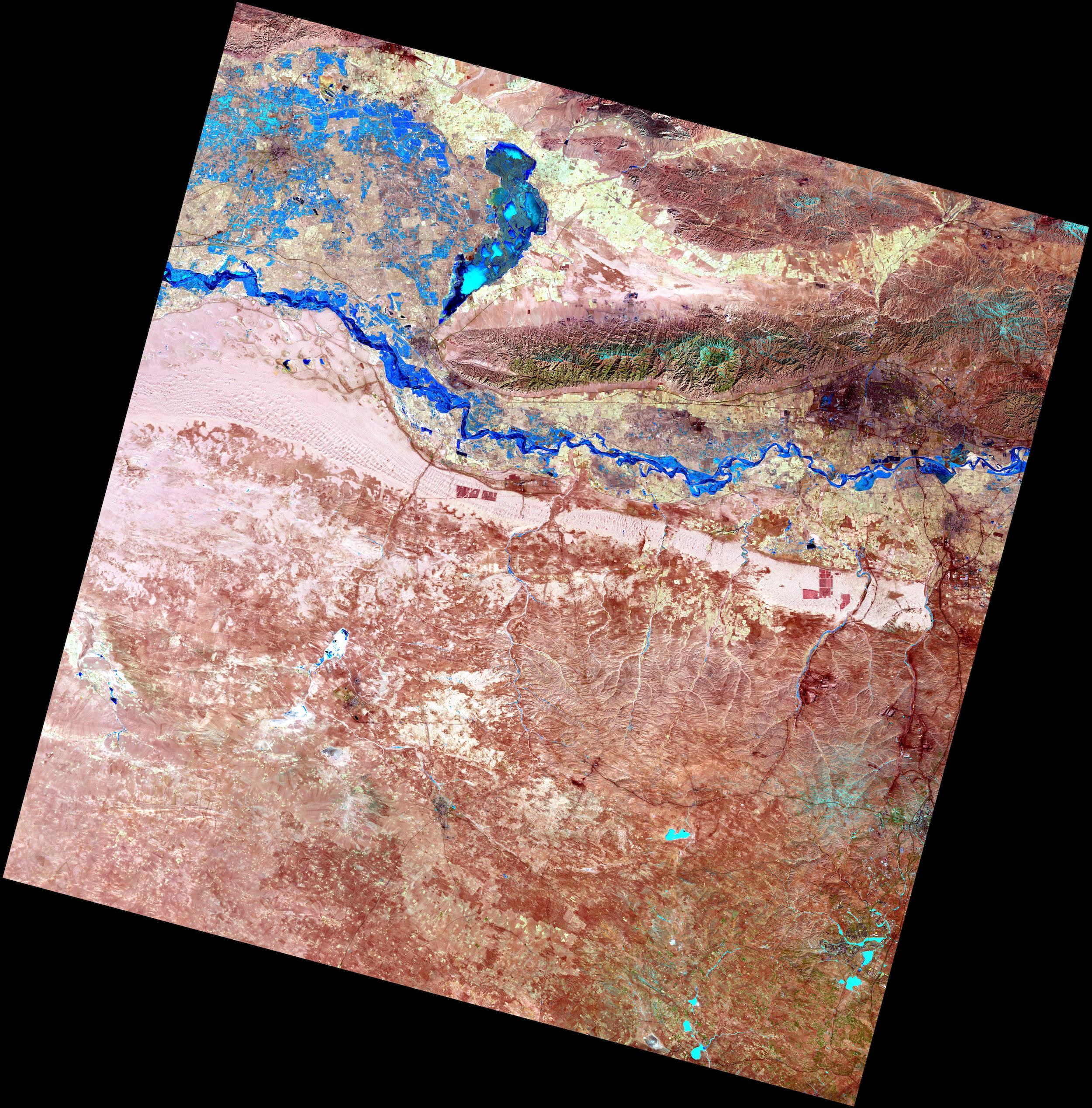
LANDSAT-9 image captured on March 4,2022, a composite of bands 6-5-4,shows Bayannur reach of the Yellow River in north China's Inner Mongolia.(Image credit: RSGS)
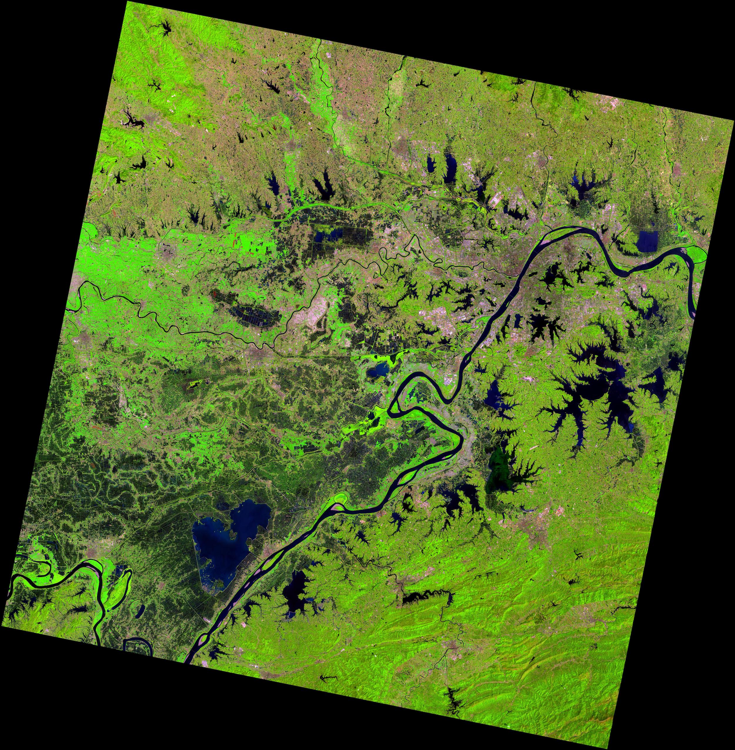
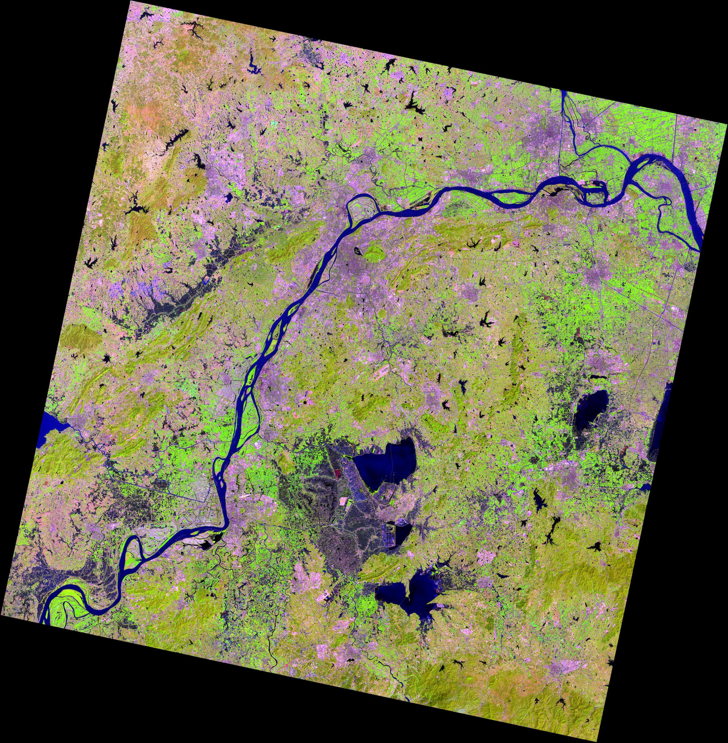
LANDSAT-9 image captured on April 11,2022, a composite of bands 6-5-4, shows Wuhan, the capital of Hubei Province in Central China. It is located at the confluence of the Han and Yangtze rivers and consists of a conurbation of three adjacent former cities-Hankou, Hanyang, and Wuchang. (Image credit: RSGS)
News & Events