Satellite Images Show Environmental Change
Satellite images shed light on how natural & cultural landscapes are changing. The images are provided by the China Remote Sensing Satellite Ground Station (RSGS), a national major S&T infrastructure hosted by the Aerospace Information Research Institute, Chinese Academy of Sciences.
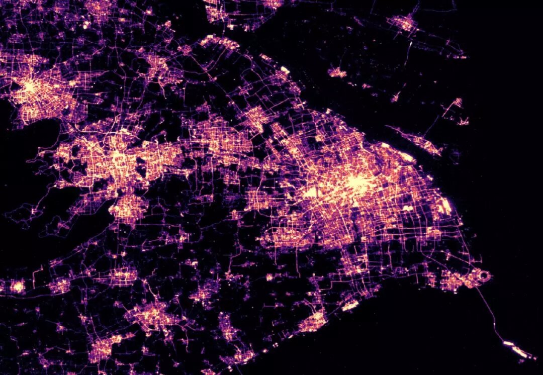
Nightlight satellite image of Yangtze River Delta sheds light on regional economy
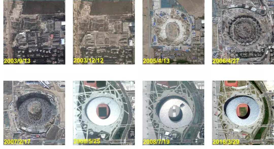
How the “bird’s nest” is built - National Stadium, Beijing
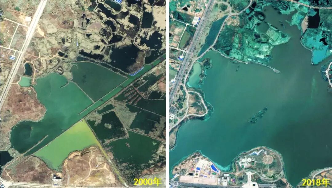
The past and present of Tongling River Dolphin National Nature Reserve, Anhui Province
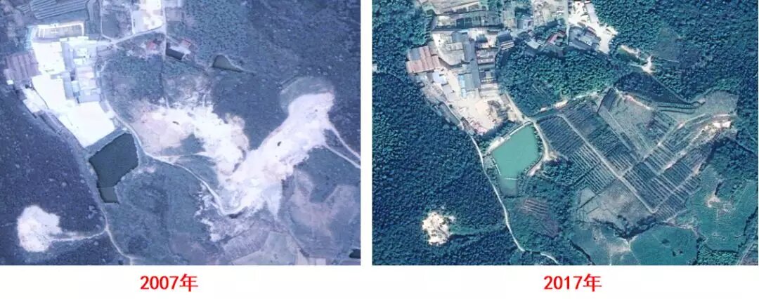
Ecological restoration of mining- Anji, Zhejiang Province
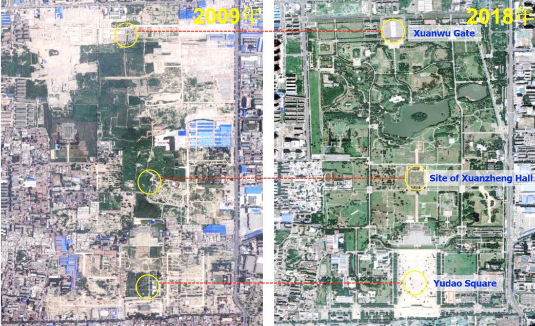
Urban cultural landscape - Daming Palace National Heritage Site Park, Xi’an City, Shaanxi Province
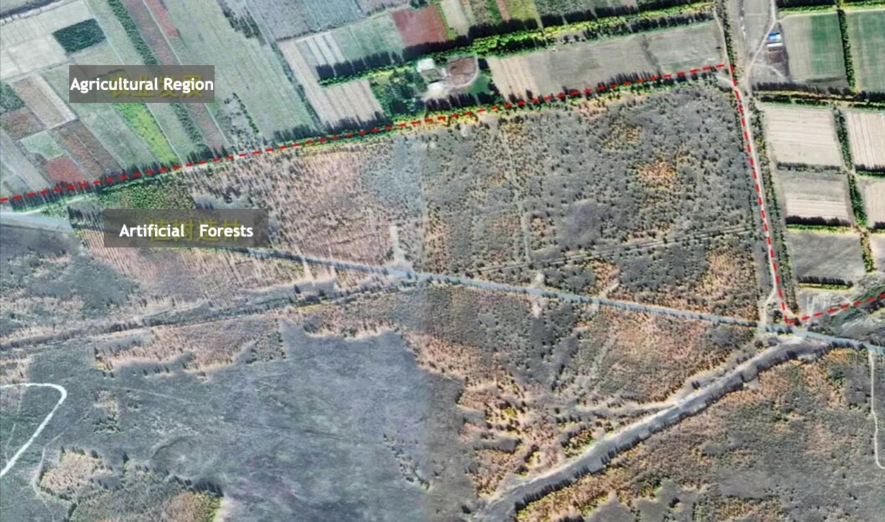
Tree-planting in Kubuqi desert builds Great Green Wall for local agriculture development - Inner Mongolia
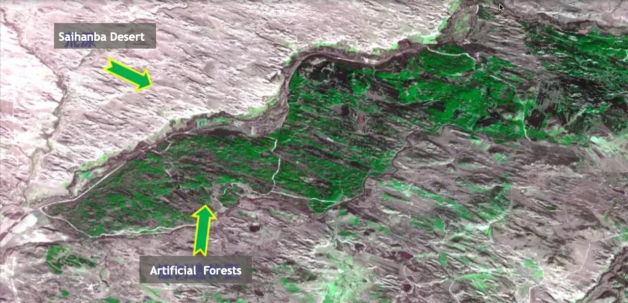
Artificial forests planted in Saihanba provide important environmental shields for Beijing-Tianjin-Hebei region against sandstorms
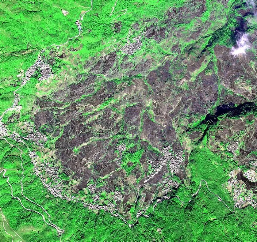
Cultural Landscape of Honghe Hani Rice Terraces, Yunan Province
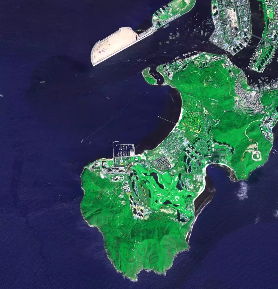
Deer Turning Head Park (or Luhuitou Park) at Sanya City, Hainan Province
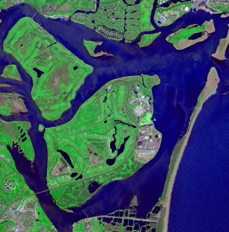
A small town famous for the Boao Forum for Asia, located next to the eastern coastal city of Qionghai in Hainan Province
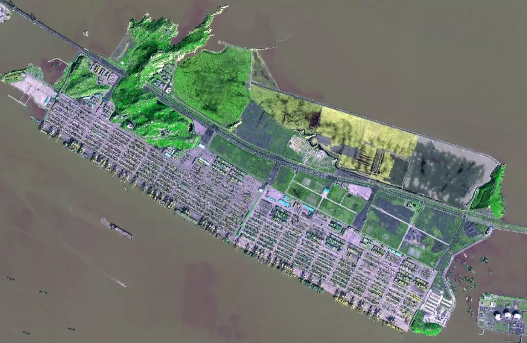
Yangshan Port, a deep water port for container ships in Hangzhou Bay south of Shanghai
News & Events