Most Detailed Map of Water Bodies Across Tibetan Plateau Produced
May 28, 2024
Terrestrial water bodies (WBs), including lakes, ponds, and reservoirs, are pivotal components of Earth's hydrological and biogeochemical systems, offering vital ecosystem services. Yet, conventional studies often overlook small water bodies or overstate their prevalence. This is particularly true for regions like the Tibetan Plateau, which is home to numerous alpine lakes. In these areas, human impact is minimal, and the number of small water bodies is increasing due to glacier melting.
In a recent effort, researchers from the Aerospace Information Research Institute (AIR) at the Chinese Academy of Sciences (CAS) have unveiled an unprecedentedly detailed dataset illuminating the complex network of water bodies sprawled across the Tibetan Plateau. Unlike previous studies, which primarily zoomed in on larger water bodies, this dataset paints a holistic picture by furnishing a high-resolution map of water bodies, pinpointing details down to a remarkable 2-meter precision for the year 2020.
Published in Scientific Data, the study unveils the map and statistical data on inland water bodies across the Tibetan Plateau in 2020, openly accessible on Figshare.
Produced with stringent quality control measures, the dataset underwent manual scrutiny to ensure precision. Leveraging Gaofen-1 satellite data and harnessing the Swin-UNet model, researchers achieved an impressive overall accuracy of 98%. Though the IOU, a metric commonly used to evaluate the performance of object detection algorithms, is slightly lagged at 68%, which may result from the small covering proportion of water bodies in an image, manual corrections guided by visual interpretation fine-tuned the extracted water bodies, enhancing data fidelity.
Comparisons with previous studies yielded intriguing insights. The total area of water bodies exceeding 1 km2 soared to 51,034.6 km2, eclipsing earlier estimates, indicating a burgeoning water body landscape. Analysis of size-abundance relationships unveiled a shoreline fractal dimension of 1.263 (R2=0.966), and the deviations from conventional power law distributions comes from larger water bodies.
Spatial resolution comparisons underscored the resolution's impact on parameter estimation, with finer resolutions yielding superior results, especially in abundance estimation. Moreover, the dataset underscores the pivotal role of small water bodies in regional biogeochemical cycles, despite their modest surface area, owing to their heightened fluxes and reaction rates compared to larger lakes.
In sum, the dataset furnishes an invaluable resource for deciphering the distribution and traits of inland water bodies on the Tibetan Plateau. It underscores the indispensability of high-resolution data in accurately gauging water body abundance and morphological attributes, particularly emphasizing the ecological significance of these smaller water bodies in regional biogeochemical processes.
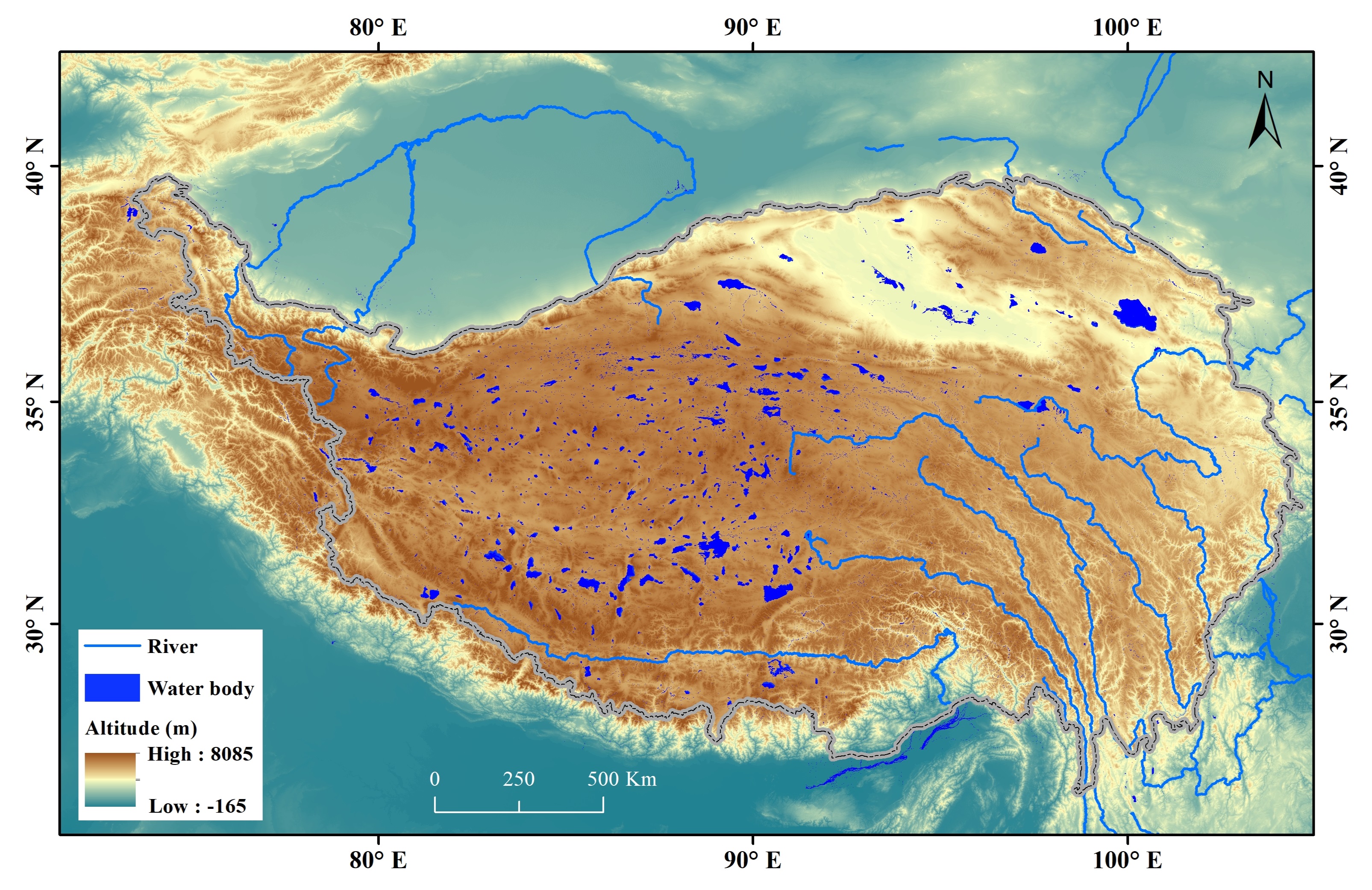
Lakes across the Tibetan Plateau. (Image by AIR)
Contact: luyq@aircas.ac.cn
News & Events